North Carolina Historical Maps and Atlases
The state of North Carolina collection contains 101 atlases spanning 385 years of growth and development (1619 through 2004).
Within the atlases are 11,503 historical maps, illustrations, and histories many of which contain family names ideal for genealogical research. Others are rare antique maps, part of the collection by an exclusive arrangement with the Osher Map Library. The state of North Carolina has 24 of these antiquarian maps dating back as early as 1619.
|
Displaying 1- 50 of 94 in total
|
Next >> |
Click on a column header to sort table.
|
Name |
Attributes |
Quality |
Publisher |
State |
Date |
|
Name |
Atlas |
Attributes |
Publisher |
Date |
Collection |
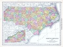 |
North Carolina |
World Atlas 1913 |
 |
Rand McNally and Com... |
1913 |
HMW |
 |
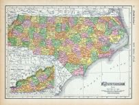
North Carolina, South Carolina... |
World Atlas 1864 Mitchells New... |
|
S. Augustus Mitchell |
1864 |
HMW |
 |
Page 072 - North Carolina |
World Atlas 1911c from Minneso... |
|
Rand, McNally and Co... |
1911 |
HMW |
 |
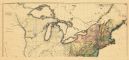
Map - Page 1 |
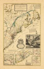
A New and Accurate Map of the ... |
|
Bowen, Emanuel |
1747 |
OML |
|
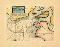 |
Map - Page 1 |
A Plan of Port Royal Harbour i... |
|
Moll, Herman |
1729 |
OML |
|
 |
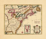
Map - Page 1 - A MAP of the/BR... |
A MAP of the/BRITISH/AMERICAN ... |
|
BOWEN, EMANUEL |
1754 |
OML |
|
 |
Map - Page 1 - A MAP OF THE/UN... |
A MAP OF THE/UNITED STATES/of/... |
|
ARROWSMITH, AARON |
1799 |
OML |
|
 |
Map - Page 1 - A New MAP of/th... |
A New MAP of/the/BRITISH DOMIN... |
|
ANNUAL REGISTER / KI... |
1763 |
OML |
|
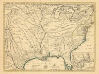 |
Map - Page 1 - CARTE DE LA LOU... |
CARTE DE LA LOUISIANE ET DU CO... |
|
DELISLE, GUILLAUME |
1718 |
OML |
|
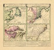 |
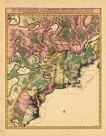
Map - Page 1 - DOMINIA ANGLORU... |
DOMINIA ANGLORUM/in/AMERICA SE... |
|
HOMANN HEIRS/MOLL, H... |
1737- |
OML |
|
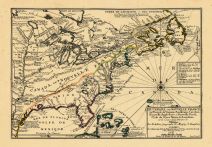 |
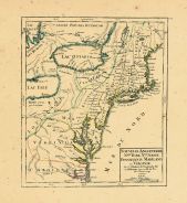
Map - Page 1 - LE CANADA,ou NO... |
LE CANADA,ou NOUVELLE FRANCE/R... |
|
FER, NICOLAS de |
1702 |
OML |
|
 |
Map - Page 1 - MAPPA/GEOGRAPHI... |
MAPPA/GEOGRAPHICA/AMERICAE/SEP... |
|
EULER, LEONHARD von |
1755 |
OML |
|
 |
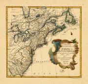
Map - Page 1 - New and Exact M... |
New and Exact MAP of the DOMIN... |
|
MOLL, HERMAN |
1732+ |
OML |
|
 |
Map - Page 1 - NOUVELLE ANGLET... |
NOUVELLE ANGLETERRE/NLLE. YORK... |
|
VAUGONDY, ROBERT de,... |
1749 |
OML |
|
 |
Map - Page 1 - NOVA TABULA GEO... |
NOVA TABULA GEOGRAPHICA COMPLE... |
|
VISSCHER, NICOLAS / ... |
1700- |
OML |
|
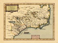 |
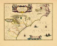
Map - Page 1 - VIRGINIA ITEM e... |
VIRGINIA ITEM et FLORIDAE |
|
DU SAUZET, HENRI |
1734 |
OML |
|
 |
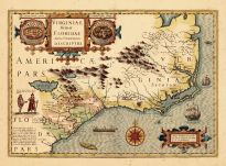
Map - Page 1 - VIRGINIAE ITEM ... |
VIRGINIAE ITEM ET FLORIDAE AME... |
|
HONDIUS, JODOCUS |
1630 |
OML |
|
 |
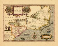
Map - Page 1 - VIRGINIAE ITEM ... |
VIRGINIAE ITEM ET FLORIDAE AME... |
|
HONDIUS, JODOCUS |
1619 |
OML |
|
 |
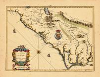
Map - Page 1 - VIRGINIAE/parti... |
VIRGINIAE/partis australis,/et... |
|
BLAEU, WILLEM |
1640 |
OML |
|
 |
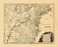
Map - Page 1 Z |
A New Description of Carolina |
|
Speed, John |
1676 |
OML |
|
 |
Map - Page 11 - LE COLONIE UNI... |
LE COLONIE UNITE DELL AMERICA ... |
|
MITCHELL, JOHN / ZAT... |
1778 |
OML |
|
 |
Map - Page 3 - ATLAS/TO ACCOMP... |
ATLAS/TO ACCOMPANY THE OFFICIA... |
|
DAVIS, MAJOR GEORGE ... |
1891 |
OML |
|
 |
Map - Page 4 - UNITED STATES o... |
UNITED STATES of Nth. AMERICA/... |
|
TARDIEU, P.F. [AFTER... |
1812 |
OML |
|
 |
Map - Page 8 - LE COLONIE UNIT... |
LE COLONIE UNITE DELL AMERICA ... |
|
MITCHELL, JOHN / ZAT... |
1778 |
OML |
|
|
Displaying 1- 50 of 94 in total
|
Next >> |

 Cart
Cart