 |
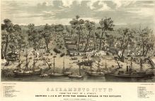
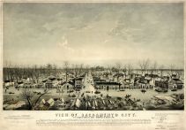
Sacramento 1849 Bird's Eye View 17x26 |
Sacramento 1849 Aerial View |
Stringer and Townsend |
1849 |
 |
Sacramento 1850 Bird's Eye View 17x24 |
Sacramento 1850 Bird's Eye View |
Sarony and Napoleon |
1850 |
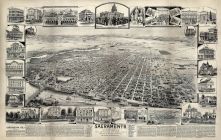 |
Sacramento 189x Bird's Eye View 17x26 |
Sacramento 189x Bird's Eye View |
Daily Record Union |
189x |
 |
Page 023, Scandinavian Colony, Helm Colony, Clovis, Fincher Colony, Eggers Colony, Kutner Colony, Sacramento Bank Colony |
Fresno County 1907 |
William Harvey, Sr. |
1907 |
 |
Page 001, Sacramento County |
San Joaquin County 1911 |
Chas H. Young |
1911 |
 |
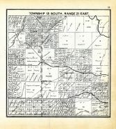
Page 002, Galt, Dry Creek, Sacramento County |
San Joaquin County 1911 |
Chas H. Young |
1911 |
 |
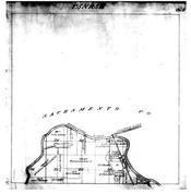
Page 003, Sacramento County |
San Joaquin County 1911 |
Chas H. Young |
1911 |
 |
Page 004, Sacramento County |
San Joaquin County 1911 |
Chas H. Young |
1911 |
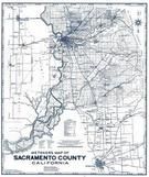 |
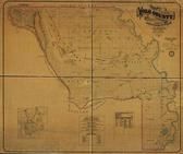
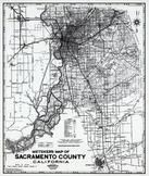
Sacramento County 1950c |
Sacramento County 1950c |
Chas. F. Metsker |
1950 |
|
|
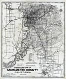
Sacramento County 1950c |
Sacramento County 1950c |
Chas. F. Metsker |
1950 |
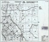 |
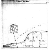
Page 072 - Township 30 N., Range 3 W., Sacramento River |
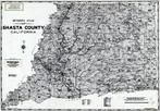
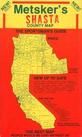
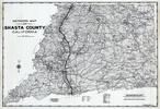
Shasta County 1959 |
Metsker Maps |
1959 |
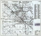 |
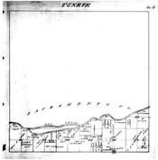
Page 082 - Township 30 N., Range 4 W., Anderson, Sacramento River |
Shasta County 1959 |
Metsker Maps |
1959 |
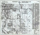 |
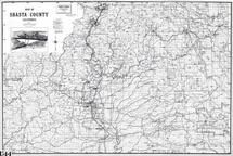
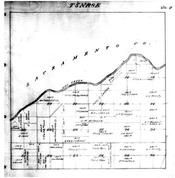
Page 083 - Township 31 N., Range 4 W., Enterprise, Redding, Sacramento River |
Shasta County 1959 |
Metsker Maps |
1959 |
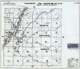 |
Page 089 - Township 37 N., Range 4 W., Sacramento River, Hazel Creek, Sims |
Shasta County 1959 |
Metsker Maps |
1959 |
 |
Sacramento County 1980 to 1996 Mylar |
Sacramento County 1980 to 1996 |
Metsker Maps |
1980 |
 |
Sacramento County 1980 to 1996 Tracing |
Sacramento County 1980 to 1996 |
Metsker Maps |
1980 |

 Cart
Cart