
 Cart
CartLocation Search results for "Isle Au Haut" in Maine
Map Matches for "Isle Au Haut" (3) in Maine
Click on a column header to sort results table.
| Name | Atlas | Publisher | Date | |
|---|---|---|---|---|
 |
Hancock County Township 9, Eastbrook, Franklin, Isle Au Haut | Hancock County 1881 | S. F. Colby & Co. | 1881 |
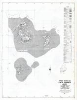 |
Knox County - Section 22 - Matinicus Isle, Criehaven, Seal Island, Isle Au Haut, Penobscot, Vinalhaven | Maine State Atlas 1961 to 1964 Highway Maps | Maine State Highway Commision | 1961 |
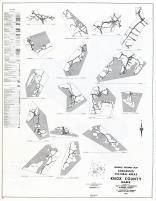 |
Knox County - Matinicus Isle, Isle Au Haut, Vinalhaven, Thomaston, St. George, Cushing, Owls Head, Friendship, Camden | Maine State Atlas 1961 to 1964 Highway Maps | Maine State Highway Commision | 1961 |
Atlas Matches for "Isle Au Haut" (0) in Maine
You may find "Isle Au Haut" in these Maine atlases:
Click on a column header to sort results table.
| Atlas | Publisher | Date | ||
|---|---|---|---|---|
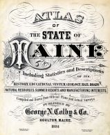 |
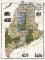
Maine State Atlas 1884 |    |
Geo N. Colby & Co. | 1884 |
 |
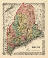
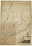
Maine State Map 1860 |  |
Augustus Mitchell Clerk of Court PA | 1860 |
 |
Maine State Map 1866 | |
A. J. Johnson | 1866 |
 |
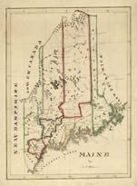
Maine State Map 1855 | |
Geo. N. Colby | 1855 |
 |
Maine State Map 1908 Revised 1914 | |
L. L. Poates | 1914 |
 |
Maine State Map 1855 Wall Map |  |
J. B. Mansfield | 1855 |
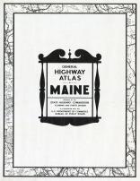 |
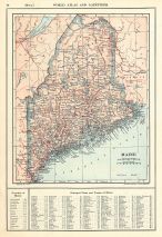
Maine State Atlas 1961 to 1964 Highway Maps | |
Maine State Highway Commision | 1961 |
 |
Maine State Map 1799c MHS Digital Image 5103 | |
Osgood Carleton | 1799c |
 |
Maine State Map 182x | |
Perkins, A.T. | 182x |