
 Cart
CartAddress Search
Results for "Latitude 43.240523, Longitude -70.596275"
View these maps overlayed on top of a modern map. You must be a member and logged in to use this feature.
Purchase a series of maps or images documenting the environmental or land use history of this location.
 A variety of printed products can be purchased by clicking on each individual map in the results below.
Click on any of the maps below to view a large, zoomable map.
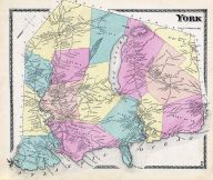 |
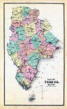
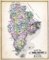
York York County 1872 show address on this map |
Sanford, Everts and Co. | 1872 |
 |
Lake Champlain 1776 MHS Digital Image 2732 Lake Champlain 1776 MHS Digital Image 2732 show address on this map |
William Brasier | 1776 |
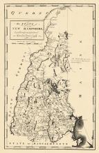 |
New Hampshire State Map 1794 New Hampshire State Map 1794 show address on this map |
Samuel Lewis | 1794 |
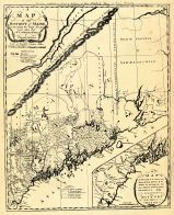 |
Sullivan's District Map of Maine 1795 Sullivan's District Map of Maine 1795 show address on this map |
Sullivan | 1795 |
 |
Maine State Map 1799c MHS Digital Image 5103 Maine State Map 1799c MHS Digital Image 5103 show address on this map |
Osgood Carleton | 1799c |
 |
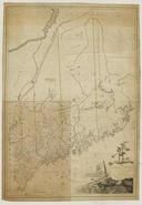
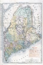
Maine State Map 182x Maine State Map 182x show address on this map |
Perkins, A.T. | 182x |
 |
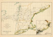
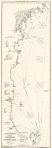
Maine to Rhode Island 1851 Coast Survey Chart Maine to Rhode Island 1851 Coast Survey Chart show address on this map |
A. D. Bache Superintendent | 1851 |
 |
Maine State Map 1855 Wall Map Maine State Map 1855 Wall Map show address on this map |
J. B. Mansfield | 1855 |
 |
York County 1856 Wall Map York County 1856 Wall Map show address on this map |
J.L. Smith & Co. | 1856 |
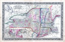 |
New York, New Hampshire, Vermont 1864 Mitchell Plate New York, New Hampshire, Vermont 1864 Mitchell Plate show address on this map |
S. Augustus Mitchell | 1864 |
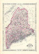 |
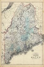
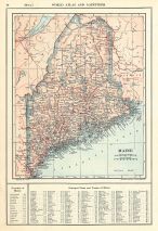
Maine State Map 1866 Maine State Map 1866 show address on this map |
A. J. Johnson | 1866 |
 |
York County York County 1872 show address on this map |
Sanford, Everts and Co. | 1872 |
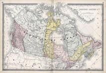 |
British America Wells County 1881 show address on this map |
H.H. Hardesty | 1881 |
 |
St. Croix and Hudson Rivers and Lake Ontario Chart 1882 New England St. Croix and Hudson River and Lake Ontario Chart 1882 New England show address on this map |
U. S. Coastal Survey | 1882 |
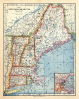 |
New England 1883 New England 1883 show address on this map |
Van Antwerp Bragg and Co. | 1883 |
 |
York County Map Maine State Atlas 1884 show address on this map |
Geo N. Colby & Co. | 1884 |
 |
United States Map Winnebago County and Boone County 1886 show address on this map |
H. R. Page & Co. | 1886 |
 |
Maine 1887 County and Township Map Maine 1887 County and Township Map show address on this map |
M. Bradley and Bros. | 1887 |
 |
New Hampshire and Vermont 1880 State Map New Hampshire and Vermont State Map 1880 Vermont 1888 Directory show address on this map |
Wm. P. Northrup and Co. | 1888 |
 |
Land Survey of the United States Cass County 1893 show address on this map |
D.W. Ensign & Co. | 1893 |
 |
The World Map with Principal Cities of the Old World Fillmore County 1896 show address on this map |
Geo. A. Ogle & Co. | 1896 |
 |
United States Map Genesee County 1899 show address on this map |
Homer A. Day | 1899 |
 |
New Hampshire and Vermont State Map New Hampshire and Vermont State Map 1899 Vermont 1902 Directory show address on this map |
Matthews-Northrup Co. | 1902 |
 |
World Map Rooks County 1904 to 1905 show address on this map |
Geo. A. Ogle & Co. | 1904 |
 |
Maine Railroad Map 1906 Maine Railroad Map 1906 show address on this map |
Rand-McNally | 1906 |
 |
United States Map Waushara County 1906c show address on this map |
C.A. McIntyre and C.H. Terril | 1906c |
 |
Gloucester to Kennebec River Chart E 1909 Revised 1913 Eldridge Gloucester to Kennebec River Chart E 1909 Revised 1913 Eldridge show address on this map |
Geo. E. Eldridge | 1913 |
 |
Maine State Map 1908 Revised 1914 Maine State Map 1908 Revised 1914 show address on this map |
L. L. Poates | 1914 |
 |
World Map Guthrie County 1917c show address on this map |
Kenyon Company | 1917c |