Click on any of the maps below to view a large, zoomable map.
 |
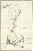
Salem, Marblehead, Beverly, Manchester Harbors Survey 1806 - APSdigobj3520
Salem, Marblehead, Beverly, Manchester Harbors Survey 1806
show address on this map
|
Bowditch, Nathaniel, 1773-1838; Burchmore, George; Ropes, William III |
1806 |
 |
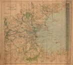
Marblehead, Lynnfield Center
Essex County 1872
show address on this map
|
D. G. Beers |
1872 |
 |
Marblehead Town
Essex County 1884
show address on this map
|
Geo. H. Walker & Co. |
1884 |
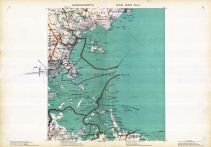 |
Plate 005, Boston, Suffolk, Norfolk, Plymouth, Saugus, Marblehead, Cohasset, Quincy
Massachusetts State Atlas 1891
show address on this map
|
Geo. H. Walker & Co. |
1891 |
 |
Plate 014 - Marblehead
Salem - Marblehead - Peabody - Danvers 1897
show address on this map
|
G. M. Hopkins, CE |
1897 |
 |
Plate 005 - Quincy, Nahant, Beverly, Chelsea, Hingham, Cohasset
Massachusetts State Atlas 1900
show address on this map
|
Geo. H. Walker & Co. |
1900 |
 |
Boston 1902 Public Reservations and Parks
Boston 1902 Public Reservations and Parks
show address on this map
|
Metropolitan Park Commision |
1902 |
 |
Plate 005 - Quincy, Weymouth, Hingham, Cohasset, Nahant, Beverly, Chelsea
Massachusetts State Atlas 1904
show address on this map
|
Geo. H. Walker & Co. |
1904 |
 |
Plate 005 - Nahant, Revere, Quincy, Weymouth, Hingham
Massachusetts State Atlas 1909
show address on this map
|
Walker Lithograph & Publishing Co. |
1909 |
 |
Index Map and Street Index
Swampscott 1920
show address on this map
|
Sanborn Map Company |
1920 |
 |
Massachusetts 1775 MHS Digital Image 0513
Massachusetts 1775 MHS Digital Image 0513
show address on this map
|
Bernard Romans |
1775 |
 |
Lake Champlain 1776 MHS Digital Image 2732
Lake Champlain 1776 MHS Digital Image 2732
show address on this map
|
William Brasier |
1776 |
 |
Boston Harbor Chart 1790 Des Barres
Boston Harbor Chart 1790 Des Barres
show address on this map
|
Des Barres |
1790 |
 |
Massachusetts 1790c MHS Digital Image 5055
Massachusetts 1790c MHS Digital Image 5055
show address on this map
|
Jeremy Belknap |
1790c |
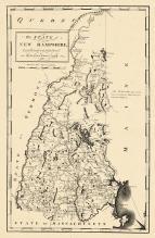 |
New Hampshire State Map 1794
New Hampshire State Map 1794
show address on this map
|
Samuel Lewis |
1794 |
 |
Massachusetts 1802 MHS Digital Image 2113
Massachusetts 1802 MHS Digital Image 2113
show address on this map
|
Osgood Carleton |
1802 |
 |
Middlesex County 1830c MHS Digital Image 4297
Middlesex County 1830c MHS Digital Image 4297
show address on this map
|
James G. Carter |
1830c |
 |
Massachusetts and Rhode Island 1850 MHS Digital Image 5155
Massachusetts and Rhode Island 1850 MHS Digital Image 5155
show address on this map
|
Unattributed |
1850 |
 |
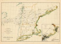
Maine to Rhode Island 1851 Coast Survey Chart
Maine to Rhode Island 1851 Coast Survey Chart
show address on this map
|
A. D. Bache Superintendent |
1851 |
 |
Boston 1852 Boston and Vicinity Wall Map with background
Boston 1852 Boston and Vicinity Wall Map
show address on this map
|
J. B. Shields |
1852 |
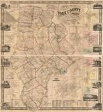 |
York County 1856 Wall Map
York County 1856 Wall Map
show address on this map
|
J.L. Smith & Co. |
1856 |
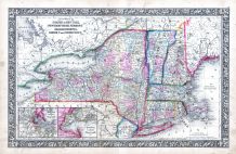 |
New York, New Hampshire, Vermont 1864 Mitchell Plate
New York, New Hampshire, Vermont 1864 Mitchell Plate
show address on this map
|
S. Augustus Mitchell |
1864 |
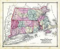 |
State Map - Connecticut Massachusetts Rhode Island
Litchfield County 1874
show address on this map
|
F. W. Beers & Co. |
1874 |
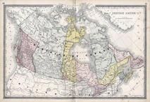 |
British America
Wells County 1881
show address on this map
|
H.H. Hardesty |
1881 |
 |
St. Croix and Hudson Rivers and Lake Ontario Chart 1882 New England
St. Croix and Hudson River and Lake Ontario Chart 1882 New England
show address on this map
|
U. S. Coastal Survey |
1882 |
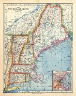 |
New England 1883
New England 1883
show address on this map
|
Van Antwerp Bragg and Co. |
1883 |
 |
United States Map
Winnebago County and Boone County 1886
show address on this map
|
H. R. Page & Co. |
1886 |
 |
Land Survey of the United States
Cass County 1893
show address on this map
|
D.W. Ensign & Co. |
1893 |
 |
The World Map with Principal Cities of the Old World
Fillmore County 1896
show address on this map
|
Geo. A. Ogle & Co. |
1896 |
 |
United States Map
Genesee County 1899
show address on this map
|
Homer A. Day |
1899 |
 |
New Hampshire and Vermont State Map
New Hampshire and Vermont State Map 1899 Vermont 1902 Directory
show address on this map
|
Matthews-Northrup Co. |
1902 |
 |
World Map
Rooks County 1904 to 1905
show address on this map
|
Geo. A. Ogle & Co. |
1904 |
 |
United States Map
Waushara County 1906c
show address on this map
|
C.A. McIntyre and C.H. Terril |
1906c |
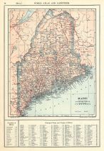 |
Maine State Map 1908 Revised 1914
Maine State Map 1908 Revised 1914
show address on this map
|
L. L. Poates |
1914 |
 |
World Map
Guthrie County 1917c
show address on this map
|
Kenyon Company |
1917c |

 Cart
Cart A variety of printed products can be purchased by clicking on each individual map in the results below.