
 Cart
CartAddress Search
Results for "Latitude 42.298811, Longitude -73.998186"
View these maps overlayed on top of a modern map. You must be a member and logged in to use this feature.
Purchase a series of maps or images documenting the environmental or land use history of this location.
 A variety of printed products can be purchased by clicking on each individual map in the results below.
Click on any of the maps below to view a large, zoomable map.
 |
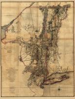
Page 013 - Cairo Township, Forge and Acra Greene County 1867 show address on this map |
F. W. Beers, A. D. Ellis & G. G. Soule | 1867 |
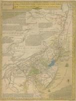 |
Pennsylvania, New Jersey, New York, Delaware 1749 - APSdigobj3524 Pennsylvania, New Jersey, New York, Delaware 1749 show address on this map |
Evans, Lewis, 1700?-1756 | 1749 |
 |
New York Province 1779 Land Tracts new New York Province 1779 Land Tracts show address on this map |
Claude Joseph Sauthier | 1779 |
 |
Herkimer County 1790 Land Patents of Southside of the Mohawk River Reproduced in 18xx Herkimer County 1790 Land Patents of Southside of the Mohawk River Reproduced in 18xx show address on this map |
De Witt, Siemon | 1790 |
 |
Pennsylvania 1791c - APSdigobj3529 Pennsylvania 1791c show address on this map |
Adlum, John, 1759-1836; Wallis, John | 1791c |
 |
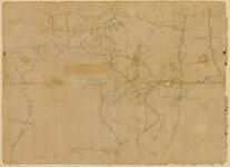
Map Image New York from the Hudson River west to the Unadilla Branch of the Susquehanna River 17xx show address on this map |
William Harper | 17xx |
 |
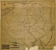
Pennsylvania 1807 including neighboring states - APSdigobj3463 Pennsylvania 1807 including neighboring states show address on this map |
Pursh, Frederick, 1774-1820 | 1807 |
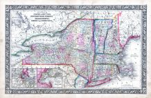 |
New York, New Hampshire, Vermont 1864 Mitchell Plate New York, New Hampshire, Vermont 1864 Mitchell Plate show address on this map |
S. Augustus Mitchell | 1864 |
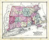 |
State Map - Connecticut Massachusetts Rhode Island Litchfield County 1874 show address on this map |
F. W. Beers & Co. | 1874 |
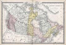 |
British America Wells County 1881 show address on this map |
H.H. Hardesty | 1881 |
 |
St. Croix and Hudson Rivers and Lake Ontario Chart 1882 New England St. Croix and Hudson River and Lake Ontario Chart 1882 New England show address on this map |
U. S. Coastal Survey | 1882 |
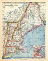 |
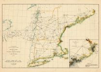
New England 1883 New England 1883 show address on this map |
Van Antwerp Bragg and Co. | 1883 |
 |
United States Map Winnebago County and Boone County 1886 show address on this map |
H. R. Page & Co. | 1886 |
 |
Land Survey of the United States Cass County 1893 show address on this map |
D.W. Ensign & Co. | 1893 |
 |
The World Map with Principal Cities of the Old World Fillmore County 1896 show address on this map |
Geo. A. Ogle & Co. | 1896 |
 |
United States Map Genesee County 1899 show address on this map |
Homer A. Day | 1899 |
 |
World Map Rooks County 1904 to 1905 show address on this map |
Geo. A. Ogle & Co. | 1904 |
 |
United States Map Waushara County 1906c show address on this map |
C.A. McIntyre and C.H. Terril | 1906c |
 |
World Map Guthrie County 1917c show address on this map |
Kenyon Company | 1917c |