
 Cart
CartAddress Search
Results for "Latitude 41.4986003, Longitude -81.6699924"
View these maps overlayed on top of a modern map. You must be a member and logged in to use this feature.
Purchase a series of maps or images documenting the environmental or land use history of this location.
 A variety of printed products can be purchased by clicking on each individual map in the results below.
Click on any of the maps below to view a large, zoomable map.
 |
Cleveland City - Part 011 Cuyahoga County 1892 show address on this map |
Geo. F. Cram & Co. | 1892 |
 |
Plate 010 Cleveland 1898 show address on this map |
A.H. Mueller | 1898 |
 |
Plate 006 Cleveland and Suburbs 1912 Vol 1 show address on this map |
G.M. Hopkins Co. | 1912 |
 |
Plate 009 Left Cleveland 1922 Revised 1924 Vol 4 show address on this map |
G. M. Hopkins Co. | 1922 |
 |
Plate 006 Cleveland 1932 Revised 1942 Vol 1 show address on this map |
G.M. Hopkins Co. | 1932 |
 |
Cleveland - Ward 4 Cuyahoga County 1874 show address on this map |
Titus Simmons and Titus | 1874 |
 |
Brooklyn Township, West Cleveland, Linndale, South Brooklyn Cuyahoga County 1892 show address on this map |
Geo. F. Cram & Co. | 1892 |
 |
Plate 044 - Water System Cleveland 1912 Revised 1920 Vol 2 show address on this map |
G.M. Hopkins Co. | 1912 |
 |
Plate 022 Cleveland 1932 Revised 1942 Vol 1 show address on this map |
G.M. Hopkins Co. | 1932 |
 |
Section 8 Cleveland and Cuyahoga County 1957 show address on this map |
Commercial Survey Company | 1957 |
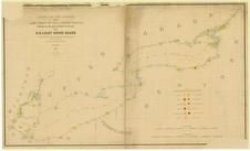 |
Lake Ontario - Lake Erie - Lake Champlain 1861 Lighthouse Charts - APSdigobj3543_001 Lake Ontario - Lake Erie - Lake Champlain 1861 Lighthouse Charts show address on this map |
Meade, George Gordon, 1815-1872 | 1861 |
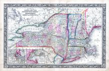 |
New York, New Hampshire, Vermont 1864 Mitchell Plate New York, New Hampshire, Vermont 1864 Mitchell Plate show address on this map |
S. Augustus Mitchell | 1864 |
 |
Ohio State Map Wayne County 1873 show address on this map |
J. A. Caldwell | 1873 |
 |
Ohio State Map Hocking County 1876 show address on this map |
Titus, Simmons & Titus | 1876 |
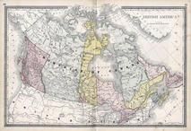 |
British America Wells County 1881 show address on this map |
H.H. Hardesty | 1881 |
 |
United States Map Winnebago County and Boone County 1886 show address on this map |
H. R. Page & Co. | 1886 |
 |
Cuyahoga County Map Cuyahoga County 1892 show address on this map |
Geo. F. Cram & Co. | 1892 |
 |
Land Survey of the United States Cass County 1893 show address on this map |
D.W. Ensign & Co. | 1893 |
 |
The World Map with Principal Cities of the Old World Fillmore County 1896 show address on this map |
Geo. A. Ogle & Co. | 1896 |
 |
United States Map Genesee County 1899 show address on this map |
Homer A. Day | 1899 |
 |
World Map Rooks County 1904 to 1905 show address on this map |
Geo. A. Ogle & Co. | 1904 |
 |
United States Map Waushara County 1906c show address on this map |
C.A. McIntyre and C.H. Terril | 1906c |
 |
Cuyahoga County Ohio State Highway Maps 1910 show address on this map |
State Highway Department of Ohio | 1910 |
 |
World Map Guthrie County 1917c show address on this map |
Kenyon Company | 1917c |