
 Cart
Cart
|
ITEM #US542100
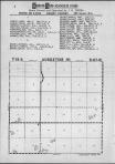
Augustine T15S-R37WFrom Logan County 1963, Kansas Published by Directory Service Company Provided by Farm and Home Publishers in 1963 |
 Buy this Map »
Maps in this atlas contain names of residents next to the symbols for homes. Some atlases published after 1983 also contain maps with names of property owners. For additional maps with names of the property owners in many counties, consult maps in Title Atlas Company, Rockford Map Publishers or Farm and Home Publishers' atlases.


Map Information
Full Title: Augustine T15S-R37W
Full Atlas Title: Logan County 1963
State: Kansas
Location 1: Unattributed
Location 2: Unattributed
Publish Date: 1963
Publisher: Directory Service Company
Number Maps in the Atlas: 31
Map Original Width: 6.74"
Map Original Height: 9.64"
Item Number: US542100
Collection: Historic Map Works Rare Historic Maps Collection
Image Quality: High quality scan of original that is perfect for printed fine-art quality reproduction.
Source Institution:

Souce Media:
Original Document
Souce Media:
Original Document
| This antique map (Augustine T15S-R37W) and atlas (Logan County 1963) are part of the Historic Map Works, Residential Genealogy™ historical map collection, the largest digital collection of rare, ancient, old, historical, cadastral and antiquarian maps of its type. We currently have over 1,662,956 images available online. You can read about the collection or browse the entire collection. |