 |
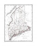
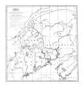
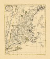
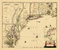
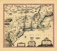
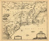
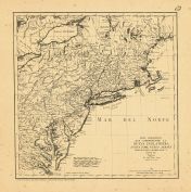
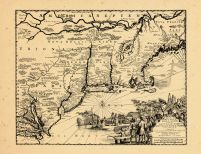
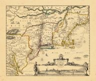
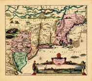
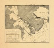
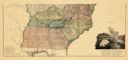
Cape Cod to Nova Scotia 1607 S... |
Cape Cod to Nova Scotia 1607 S... |
 |
Samuel de Champlain |
1607 |
HMW |
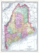 |
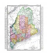
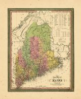
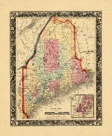
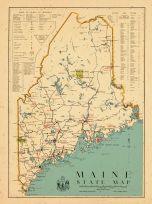
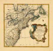
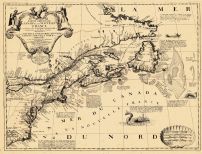
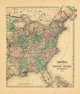
Maine |
World Atlas 1913 |
|
Rand McNally and Com... |
1913 |
HMW |
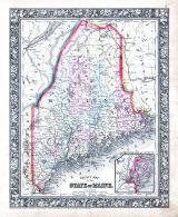 |
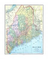
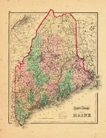
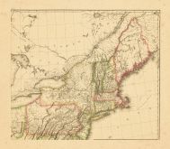
Maine |
World Atlas 1864 Mitchells New... |
|
S. Augustus Mitchell |
1864 |
HMW |
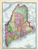 |
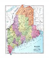
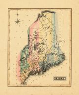
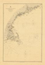
Page 060 - Maine |
World Atlas 1911c from Minneso... |
|
Rand, McNally and Co... |
1911 |
HMW |
 |
Map - Page 1 |
CITY OF/AUGUSTA/KENNEBEC CO. |
|
COLBY and STUART |
1887 |
OML |
|
 |
Map - Page 1 |
S. E. View of Portland in 1832... |
|
J. H. Bufford from a... |
1833 |
OML |
|
 |
Map - Page 1 |
BRITISH COLUMBIA |
|
CRAM, GEORGE F. |
1900 |
OML |
|
 |
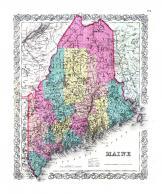
Map - Page 1 |
A New Map of Maine |
|
Samuel Augustus Mitc... |
1847 |
OML |
|
 |
Map - Page 1 |
MAINE |
|
JOSEPH HUTCHINS COLT... |
1855 |
OML |
|
 |
Map - Page 1 |
A Map of the City of Portland ... |
|
Cullum, John |
1836 |
OML |
|
 |
Map - Page 1 |
CITY OF/PORTLAND/MAINE [P148, ... |
|
CRAM, GEORGE F. |
1894 |
OML |
|
 |
Map - Page 1 |
MAINE |
|
ARROWSMITH, AARON an... |
1812 |
OML |
|
 |
Map - Page 1 |
Maine (From Atlas of the world... |
|
Rand, McNally |
1898 |
OML |
|
 |
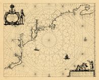
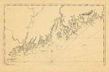
Map - Page 1 |
The Harbour of Casco Bay and I... |
|
Southack, Cyprian |
1764 |
OML |
|
 |
Map - Page 1 |
Maine |
|
L. Lewis |
1812 |
OML |
|
 |
Map - Page 1 |
Maine |
|
Bradford, T.G. |
1842 |
OML |
|
 |
Map - Page 1 |
Maine |
|
Standard Harrow |
1900 |
OML |
|
 |
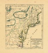
Map - Page 1 |
Plan de la Baie et du Havre de... |
|
France. Depot de la ... |
1779 |
OML |
|
 |
Map - Page 1 |
Maine |
|
Bradford, T.G. |
1838 |
OML |
|
 |
Map - Page 1 |
[ACROSS TOP OF MAP, ABOVE BORD... |
|
RAND, McNALLY and CO... |
1883 |
OML |
|
 |
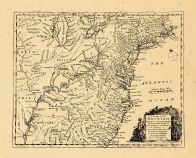
Map - Page 1 |
Map of the Northern Part of th... |
|
S.L. Dashell |
1838 |
OML |
|
 |
Map - Page 1 |
A New Map fo New England |
|
Neal, Daniel |
1720 |
OML |
|
 |
Map - Page 1 |
County Map of Maine |
|
Mitchell, Samuel, Au... |
1864 |
OML |
|
 |
Map - Page 1 |
A/New Map of/MAINE |
|
MITCHELL, S. AUGUSTU... |
1846 |
OML |
|
 |
Map - Page 1 |
MAP/of the Northern Part of th... |
|
DASHIELL, S.L. |
1898 |
OML |
|
 |
Map - Page 1 |
A New Map of Maine |
|
H.S. Tanner |
1846 |
OML |
|
 |
Map - Page 1 |
Maine |
|
A. Finley |
1824 |
OML |
|
 |
Map - Page 1 |
MAP OF THE NORTHERN PART OF TH... |
|
S.L. DASHER |
1839 |
OML |
|
 |
Map - Page 1 |
Maine: For the Maine State Yea... |
|
Colton, Ohman & Co. |
1898 |
OML |
|
 |
Map - Page 1 |
MAP OF/ANDROSCOGGIN/COUNTY/MAI... |
|
COLBY and STUART |
1887 |
OML |
|
 |
Map - Page 1 |
MAP OF/MAINE/FOR THE/MAINE STA... |
|
OHMAN, AUGUST R. |
1905 |
OML |
|
 |
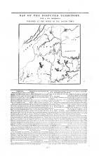
Map - Page 1 |
MAP OF THE DISPUTED TERRITORY ... |
|
FEATHERSTONHAUGH and... |
1839 |
OML |
|
 |
Map - Page 1 |
MAP OF/KENNEBEC/COUNTY/MAINE |
|
COLBY and STUART |
1887 |
OML |
|
 |
Map - Page 1 |
MAINE |
|
CRAM, GEORGE F. |
1900 |
OML |
|
 |
Map - Page 1 |
Maine |
|
Morse & Breese |
1845 |
OML |
|
 |
Map - Page 1 |
MAINE (FROMATLAS OF THE WORLD) |
|
RAND, MCNALLY |
1895 |
OML |
|
 |
Map - Page 1 |
View of the Entrance of Portla... |
|
Charles Codman |
1830 |
OML |
|
 |
Map - Page 1 |
MAINE/ENGRAVED FOR/Standard At... |
|
CRAM, GEORGE F. |
1894 |
OML |
|
 |
Map - Page 1 |
A New Map of Maine |
|
Mitchell, S. Augustu... |
1846 |
OML |
|
 |
Map - Page 1 |
MAINE |
|
HUNT & EATON |
1892 |
OML |
|
 |
Map - Page 1 |
Falmouth Harbor |
|
Des Barres, Joseph F... |
1776 |
OML |
|
 |
Map - Page 1 |
MAINE./RAILROADS. |
|
RAND McNALLY and CO. |
1902 |
OML |
|
 |
Map - Page 1 |
Maine |
|
|
|
OML |
|
 |
Map - Page 1 |
MAINE |
|
PHILLIPS & hUNT |
1885 |
OML |
|
 |
Map - Page 1 |
A New and Correct Chart of the... |
|
Barnsely, Henry |
1763 |
OML |
|
 |
Map - Page 1 |
County Map of the State of Mai... |
|
Mitchell, Samuel aug... |
1870 |
OML |
|
 |
Map - Page 1 |
MAINE./RAILROADS. [LR] // Rand... |
|
RAND McNALLY and CO. |
1903 |
OML |
|
 |
Map - Page 1 |
Map of the Northern Part of th... |
|
S.L. Dashell |
1838 |
OML |
|
 |
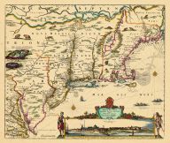
Map - Page 1 |
Nova Belgii Quod Nunc Novi Jor... |
|
[Ogilby, John] |
1671 |
OML |
|
 |
Map - Page 1 |
County Map of the State of Mai... |
|
Mitchell, Samuel Aug... |
1867 |
OML |
|
 |
Map - Page 1 |
County Map/ Of The/State Of Ma... |
|
Mitchell, S. Augustu... |
1879 |
OML |
|
 |
Map - Page 1 |
MAINE |
|
COLTON and CO., G.W.... |
1894 |
OML |
|
 |
Map - Page 1 |
L'ACADIA,LE PROVINCIE DI SAGAD... |
|
MITCHELL, JOHN / ZAT... |
1778 |
OML |
|
 |
Map - Page 1 |
Map of Maine for the Maine Reg... |
|
Ohman Map Co. |
1924 |
OML |
|
 |
Map - Page 1 |
Maine |
|
A. & C. Black |
1856 |
OML |
|
 |
Map - Page 1 |
MAP OF MAINE |
|
MATTHEWS-NORTHRUP |
1895 |
OML |
|
 |
Map - Page 1 |
Map of New England or Eastern ... |
|
S. Augustus Mitchell |
1844 |
OML |
|
 |
Map - Page 1 |
CITY OF/AUBURN/ANDROSCOGGIN CO... |
|
COLBY and STUART |
1887 |
OML |
|
 |
Map - Page 1 |
MAP OF THE DISPUTED TERRITORY ... |
|
BOSTON TIMES |
1839 |
OML |
|
 |
Map - Page 1 |
Map of the Country which was t... |
|
J. Yaeger, engraver |
1822 |
OML |
|
 |
Map - Page 1 |
[UL-]CITY OF SACO [LR-]CITY OF... |
|
COLBY and STUART |
1887 |
OML |
|
 |
Map - Page 1 |
ARRANGEMENT OF/THE BOUNDARY MA... |
|
U.S. GEOLOGICAL SURV... |
1915 |
OML |
|
 |
Map - Page 1 |
Colton's Maine |
|
J.H. Colton |
1855 |
OML |
|
 |
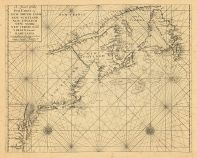
Map - Page 1 - A Chart of the ... |
A Chart of the Coast of/NEW FO... |
|
SELLER, JEREMIAH AND... |
1703 |
OML |
|
 |
Map - Page 1 - A Chart of the/... |
A Chart of the/Coast of/AMERIC... |
|
SELLER, JOHN |
1675 |
OML |
|
 |
Map - Page 1 - A Chart of the/... |
A Chart of the/Sea Coast of/NE... |
|
THORNTON, JOHN / MOU... |
1713 |
OML |
|
 |
Map - Page 1 - A CHART/OF THE/... |
A CHART/OF THE/COAST OF NEW EN... |
|
HOLLAND, SAMUEL / NO... |
1798 |
OML |
|
 |
Map - Page 1 - A Map of the BR... |
A Map of the BRITISH and FRENC... |
|
BOWEN, THOMAS |
1764 |
OML |
|
 |
Map - Page 1 - A MAP OF THE MO... |
A MAP OF THE MOST INHABITED PA... |
|
JEFFERYS, THOMAS / G... |
1755 |
OML |
|
 |
Map - Page 1 - A Map of the mo... |
A Map of the most INHABITED pa... |
|
BOWLES, JOHN/ BOWLES... |
1765- |
OML |
|
 |
Map - Page 1 - A MAP of the/BR... |
A MAP of the/BRITISH/AMERICAN ... |
|
BOWEN, EMANUEL |
1754 |
OML |
|
 |
Map - Page 1 - A MAP OF/NEW EN... |
A MAP OF/NEW ENGLAND,/Being th... |
|
FOSTER, JOHN |
1677 |
OML |
|
 |
Map - Page 1 - A Map of/NEW EN... |
A Map of/NEW ENGLAND/and ye Co... |
|
GENERAL MAGAZINE OF ... |
1755 |
OML |
|
 |
Map - Page 1 - A Map of/New EN... |
A Map of/New ENGLAND/New YORKE... |
|
MORDEN, ROBERT and B... |
1676 |
OML |
|
 |
Map - Page 1 - A MAP OF/that p... |
A MAP OF/that part of/AMERICA/... |
|
GENTLEMAN'S MAGAZINE |
1757 |
OML |
|
 |
Map - Page 1 - A MAP OF/that p... |
A MAP OF/that part of/AMERICA/... |
|
GENTLEMAN'S MAGAZINE |
1757 |
OML |
|
 |
Map - Page 1 - A MAP of/the mo... |
A MAP of/the most INHABITED pa... |
|
JEFFERYS, THOMAS / G... |
1774 |
OML |
|
 |
Map - Page 1 - A MAP./Reduced ... |
A MAP./Reduced from the offici... |
|
GALLATIN, ALBERT-GRA... |
1840 |
OML |
|
 |
Map - Page 1 - A MAP/of the/BR... |
A MAP/of the/BRITISH and FRENC... |
|
LONDON MAGAZINE |
1755 |
OML |
|
 |
Map - Page 1 - A MAP/OF THE/ST... |
A MAP/OF THE/STATE OF MAINE/FR... |
|
GREENLEAF, MOSES |
1820 |
OML |
|
 |
Map - Page 1 - A MAP/of/PORTLA... |
A MAP/of/PORTLAND MAINE/and/SO... |
|
DUDLEY, KATHERINE |
1928 |
OML |
|
 |
Map - Page 1 - A NEW AND CORRE... |
A NEW AND CORRECT MAP/OF THE/B... |
|
LAURIE and WHITTLE |
1794 |
OML |
|
 |
Map - Page 1 - A New and/ACCUR... |
A New and/ACCURATE MAP OF/NEW ... |
|
BOWEN, EMANUEL |
1752 |
OML |
|
 |
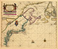
Map - Page 1 - A New Chart for... |
A New Chart for the/Seacoasts ... |
|
THORNTON, JOHN/FISHE... |
1687 |
OML |
|
 |
Map - Page 1 - A New Chart of ... |
A New Chart of the Sea Coast o... |
|
THORNTON, JOHN |
1685- |
OML |
|
 |
Map - Page 1 - A NEW MAP OF NE... |
A NEW MAP OF NEW ENGLAND-NEW Y... |
|
THORNTON, JOHN /ROBE... |
1690- |
OML |
|
 |
Map - Page 1 - A NEW MAP OF NO... |
A NEW MAP OF NOVA SCOTIA,and C... |
|
JEFFERYS, THOMAS |
1775 |
OML |
|
 |
Map - Page 1 - A NEW MAP OF NO... |
A NEW MAP OF NOVA SCOTIA,and C... |
|
JEFFERYS, THOMAS |
1775 |
OML |
|
 |
Map - Page 1 - A New MAP of/th... |
A New MAP of/the/BRITISH DOMIN... |
|
ANNUAL REGISTER / KI... |
1763 |
OML |
|
 |
Map - Page 1 - A New Map/OF TH... |
A New Map/OF THE/PROVINCE OF L... |
|
HOLLAND, SAMUEL / WY... |
1829 [1843] |
OML |
|
 |
Map - Page 1 - A NEW MAP/of/NO... |
A NEW MAP/of/NOVA SCOTIA/and/C... |
|
JEFFERYS, THOMAS |
1775 |
OML |
|
 |
Map - Page 1 - A NEW MAPP OF/N... |
A NEW MAPP OF/NEW ENGLAND/and/... |
|
BROWNE, C[HRISTOPHER... |
1714 |
OML |
|
 |
Map - Page 1 - A plan of that ... |
A plan of that part of the Dis... |
|
PARSONS, WILLIAM |
1821- |
OML |
|
 |
Map - Page 1 - A Plan of the R... |
A Plan of the Rivers/SCOODIC A... |
|
SPROULE, GEORGE [ERR... |
1895- |
OML |
|
 |
Map - Page 1 - A VIEW/of the/R... |
A VIEW/of the/RIVERS/KENEBEC a... |
|
LONDON MAGAZINE |
1776 |
OML |
|
 |
Map - Page 1 - A.bis/(Upper Sh... |
A.bis/(Upper Sheet)/U.S. COAST... |
|
U.S. COAST SURVEY |
1864 |
OML |
|
 |
Map - Page 1 - A/Correct Map o... |
A/Correct Map of the Coast/OF/... |
|
SOUTHACK, CYPRIAN |
1731 |
OML |
|
 |
Map - Page 1 - A/New and Accur... |
A/New and Accurate/MAP/of the ... |
|
UNIVERSAL MAGAZINE /... |
1757 |
OML |
|
 |
Map - Page 1 - A/New Map of/MA... |
A/New Map of/MAINE |
|
MITCHELL, S. AUGUSTU... |
1855 |
OML |
|
 |
Map - Page 1 - A/New Map of/MA... |
A/New Map of/MAINE |
|
MITCHELL, S. AUGUSTU... |
1853 |
OML |
|
 |
Map - Page 1 - A/New Map of/MA... |
A/New Map of/MAINE/BY H.S. Tan... |
|
TANNER, HENRY SCHENC... |
1842- |
OML |
|
 |
Map - Page 1 - A/New Map of/MA... |
A/New Map of/MAINE/BY H.S. Tan... |
|
TANNER, H.S. |
1845 |
OML |
|
 |
Map - Page 1 - A/New Map of/MA... |
A/New Map of/MAINE/PUBLISHED B... |
|
MITCHELL, S. AUGUSTU... |
1859 |
OML |
|
 |
Map - Page 1 - A/New Map of/MA... |
A/New Map of/MAINE/PUBLISHED B... |
|
MITCHELL, S. AUGUSTU... |
1856 |
OML |
|
 |
Map - Page 1 - A/New Map of/MA... |
A/New Map of/MAINE/PUBLISHED B... |
|
MITCHELL, S. AUGUSTU... |
1852 |
OML |
|
 |
Map - Page 1 - An accurate MAP... |
An accurate MAP of/NEW/HAMPSHI... |
|
UNIVERSAL MAGAZINE |
1781 |
OML |
|
 |
Map - Page 1 - An Exact Map/of... |
An Exact Map/of/The PROVINCE o... |
|
LODGE, J. |
1778 |
OML |
|
 |
Map - Page 1 - ATTACK of the R... |
ATTACK of the REBELS upon FORT... |
|
RAPIN, J. / TINDAL |
1785 |
OML |
|
 |
Map - Page 1 - AUGUSTA IN 1823... |
AUGUSTA IN 1823/By SEARLE |
|
NORTH, JAMES WILLIAM... |
1870 |
OML |
|
 |
Map - Page 1 - AUGUSTA, ME. |
AUGUSTA, ME. |
|
LADD, F.B. |
1854 |
OML |
|
 |
Map - Page 1 - BALLOON VIEW OF... |
BALLOON VIEW OF SACO BAY [FACS... |
|
LOCKE, J.S. |
1884 |
OML |
|
 |
Map - Page 1 - BELGII NOVI,/AN... |
BELGII NOVI,/ANGLIAE NOVAE, ET... |
|
JANSSON, JAN / SCHEN... |
1694 |
OML |
|
 |
Map - Page 1 - BELGII NOVI,/AN... |
BELGII NOVI,/ANGLIAE NOVAE, ET... |
|
JANSSONIUS, JOANNES |
1651 |
OML |
|
 |
Map - Page 1 - BIRDS EYE VIEW ... |
BIRDS EYE VIEW OF CASCO BAY- P... |
|
Geo. H. Walker & Co. |
1906 |
OML |
|
 |
Map - Page 1 - BRUNSWICK AND T... |
BRUNSWICK AND TOPSHAM/CUMBERLA... |
|
ANONYMOUS AMERICAN |
1877 |
OML |
|
 |
Map - Page 1 - CANADA/ou/NOVVE... |
CANADA/ou/NOVVELLE/FRANCE |
|
MALLET, ALAIN MANESS... |
1686 |
OML |
|
 |
Map - Page 1 - CARTA D'UNA PAR... |
CARTA D'UNA PARTE/DELL'AMERICA... |
|
BELLIN, JACQUES NICO... |
1755- |
OML |
|
 |
Map - Page 1 - Carta particola... |
Carta particolare della nuoua ... |
|
DUDLEY, ROBERT |
1661 |
OML |
|
 |
Map - Page 1 - CARTE REDUITE D... |
CARTE REDUITE DES/COSTES ORIEN... |
|
BELLIN, JACQUES NICO... |
1757 |
OML |
|
 |
Map - Page 1 - CARTE REDUITE/D... |
CARTE REDUITE/DES COTES ORIENT... |
|
DEPOT GENERAL DES CA... |
1780 |
OML |
|
 |
Map - Page 1 - CARTE/DE LA NOU... |
CARTE/DE LA NOUVELLE ANGLETERR... |
|
BELLIN, JACQUES NICO... |
1757 |
OML |
|
 |
Map - Page 1 - CARTE/de la NOU... |
CARTE/de la NOUVELLE/ANGLETERR... |
|
BERTHOLON, C. |
1799 |
OML |
|
 |
Map - Page 1 - CARTE/DE LA PAR... |
CARTE/DE LA PARTIE NORD,/DES E... |
|
BONNE, RIGOBERT |
1780 |
OML |
|
 |
Map - Page 1 - CARTE/de la/Nou... |
CARTE/de la/Nouvelle ANGLETERR... |
|
LAPORTE, JOSEPH de |
1781 |
OML |
|
 |
Map - Page 1 - CARTE/DU/THEATR... |
CARTE/DU/THEATRE DE LA GUERRE/... |
|
BRION DE LA TOUR, LO... |
1778 |
OML |
|
 |
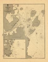
Map - Page 1 - CHART OF/PORTLA... |
CHART OF/PORTLAND HARBOR/MAINE... |
|
U.S. COAST SURVEY/A.... |
1855 |
OML |
|
 |
Map - Page 1 - CITY AND HARBOR... |
CITY AND HARBOR OF/PORTLAND/MA... |
|
PEIRCE, BENJAMIN |
1870 |
OML |
|
 |
Map - Page 1 - CITY OF/PORTLAN... |
CITY OF/PORTLAND/MAINE |
|
WATSON, GAYLORD / CR... |
1891 |
OML |
|
 |
Map - Page 1 - COLTON'S MAINE |
COLTON'S MAINE |
|
COLTON, JOSEPH H. |
1866 |
OML |
|
 |
Map - Page 1 - COLTON'S MAINE |
COLTON'S MAINE |
|
COLTON, J.H. / JOHNS... |
1859- |
OML |
|
 |
Map - Page 1 - COLTON'S/MAINE/... |
COLTON'S/MAINE/PUBLISHED BY G.... |
|
COLTON and CO., G.W.... |
1876 |
OML |
|
 |
Map - Page 1 - COLTON'S/MAINE/... |
COLTON'S/MAINE/PUBLISHED BY G.... |
|
COLTON and CO., G.W.... |
1874 |
OML |
|
 |
Map - Page 1 - COLTON'S/MAINE/... |
COLTON'S/MAINE/PUBLISHED BY G.... |
|
COLTON and CO., G.W.... |
1871 |
OML |
|
 |
Map - Page 1 - COLTON'S/MAINE/... |
COLTON'S/MAINE/PUBLISHED BY G.... |
|
COLTON and CO., G.W.... |
1872 |
OML |
|
 |
Map - Page 1 - Commercial Surv... |
Commercial Survery of New Engl... |
|
Bureau of Foreign an... |
1949 |
OML |
|
 |
Map - Page 1 - Costes et Riuie... |
Costes et Riuieres/de VIRGINIE... |
|
MICHAULT, R. / JUSTE... |
1674 |
OML |
|
 |
Map - Page 1 - COUNTY MAP/OF T... |
COUNTY MAP/OF THE/STATE OF MAI... |
|
MITCHELL, S. AUGUSTU... |
1865 |
OML |
|
 |
Map - Page 1 - COUNTY MAP/OF T... |
COUNTY MAP/OF THE/STATE OF MAI... |
|
MITCHELL, S. AUGUSTU... |
1872 |
OML |
|
 |
Map - Page 1 - COUNTY MAP/OF T... |
COUNTY MAP/OF THE/STATE OF MAI... |
|
MITCHELL, S. AUGUSTU... |
1860- |
OML |
|
 |
Map - Page 1 - COUNTY MAP/OF T... |
COUNTY MAP/OF THE/STATE OF MAI... |
|
MITCHELL, S. AUGUSTU... |
1876 |
OML |
|
 |
Map - Page 1 - COUNTY MAP/OF T... |
COUNTY MAP/OF THE/STATE OF MAI... |
|
MITCHELL, S. AUGUSTU... |
1865- |
OML |
|
 |
Map - Page 1 - COUNTY MAP/OF T... |
COUNTY MAP/OF THE/STATE OF MAI... |
|
MITCHELL, S. AUGUSTU... |
1872 |
OML |
|
 |
Map - Page 1 - COUNTY/AND/TOWN... |
COUNTY/AND/TOWNSHIP MAP/OF THE... |
|
BRADLEY, WM. M. and ... |
1887 |
OML |
|
 |
Map - Page 1 - COUNTY/AND/TOWN... |
COUNTY/AND/TOWNSHIP MAP/OF THE... |
|
BRADLEY, WM. M. and ... |
1887 |
OML |
|
 |
Map - Page 1 - DOMINIA ANGLORU... |
DOMINIA ANGLORUM/in/AMERICA SE... |
|
HOMANN HEIRS/MOLL, H... |
1737- |
OML |
|
 |
Map - Page 1 - GRAY'S ATLAS/MA... |
GRAY'S ATLAS/MAP OF/MAINE |
|
GRAY, O.W. |
1873 |
OML |
|
 |
Map - Page 1 - GRAY'S ATLAS/MA... |
GRAY'S ATLAS/MAP OF/MAINE |
|
GRAY, ORMANDO W. |
1873- |
OML |
|
 |
Map - Page 1 - GRAY'S ATLAS/MA... |
GRAY'S ATLAS/MAP OF/MAINE |
|
GRAY, ORMANDO W. |
1873- |
OML |
|
 |
Map - Page 1 - habitasion de l... |
habitasion de lile Stte croix |
|
CHAMPLAIN, SAMUEL de |
1613 |
OML |
|
 |
Map - Page 1 - J.H. COLTON'S/M... |
J.H. COLTON'S/Map of/MAINE |
|
COLTON, J.[OSEPH] H. |
1865 |
OML |
|
 |
Map - Page 1 - JOHNSON'S MAINE... |
JOHNSON'S MAINE/BY/JOHNSON AND... |
|
JOHNSON AND WARD |
1864 |
OML |
|
 |
Map - Page 1 - JOHNSON'S/MAINE... |
JOHNSON'S/MAINE/BY/JOHNSON and... |
|
JOHNSON and BROWNING |
1861 |
OML |
|
 |
Map - Page 1 - JOHNSON'S/MAINE... |
JOHNSON'S/MAINE/BY/JOHNSON and... |
|
JOHNSON and BROWNING |
1861 |
OML |
|
 |
Map - Page 1 - JOHNSON'S/MAINE... |
JOHNSON'S/MAINE/BY/JOHNSON AND... |
|
JOHNSON AND WARD |
1862 |
OML |
|
 |
Map - Page 1 - JOHNSON'S/MAINE... |
JOHNSON'S/MAINE/BY/JOHNSON AND... |
|
JOHNSON AND WARD |
1863 |
OML |
|
 |
Map - Page 1 - JOHNSON'S/MAINE... |
JOHNSON'S/MAINE/BY/JOHNSON AND... |
|
JOHNSON AND WARD |
1862 |
OML |
|
 |
Map - Page 1 - LOWER CANADA/NE... |
LOWER CANADA/NEW BRUNSWICK, NO... |
|
ARROWSMITH, JOHN |
1838 |
OML |
|
 |
Map - Page 1 - LUBEC, ME./1896... |
LUBEC, ME./1896. |
|
NORRIS, GEO. E. |
1896 |
OML |
|
 |
Map - Page 1 - MAINE |
MAINE |
|
BARTHOLOMEW, JOHN / ... |
1856- |
OML |
|
 |
Map - Page 1 - MAINE |
MAINE |
|
BRADFORD, THOMAS G. |
1835 |
OML |
|
 |
Map - Page 1 - MAINE |
MAINE |
|
SOTZMANN, DANIEL FRI... |
1798 |
OML |
|
 |
Map - Page 1 - MAINE |
MAINE |
|
BRADFORD, THOMAS G. |
1835 |
OML |
|
 |
Map - Page 1 - MAINE |
MAINE |
|
BRADFORD, THOMAS G. |
1838 |
OML |
|
 |
Map - Page 1 - MAINE |
MAINE |
|
FINLEY, ANTHONY |
1829 |
OML |
|
 |
Map - Page 1 - MAINE |
MAINE |
|
LUCAS, F. Jr. |
1824 |
OML |
|
 |
Map - Page 1 - MAINE |
MAINE |
|
SCOTT, JOSEPH |
1795 |
OML |
|
 |
Map - Page 1 - MAINE |
MAINE |
|
SCOTT, JOSEPH |
1795 |
OML |
|
 |
Map - Page 1 - MAINE |
MAINE |
|
COLTON, JOSEPH H. |
1857 |
OML |
|
 |
Map - Page 1 - MAINE |
MAINE |
|
BRADFORD, THOMAS G. |
1835 |
OML |
|
 |
Map - Page 1 - MAINE |
MAINE |
|
BRADFORD, THOMAS G. |
1835 |
OML |
|
 |
Map - Page 1 - MAINE |
MAINE |
|
CRAM, GEO. F., PUBLI... |
1890- |
OML |
|
 |
Map - Page 1 - MAINE |
MAINE |
|
BRADFORD, THOMAS G. |
1835 |
OML |
|
 |
Map - Page 1 - MAINE |
MAINE |
|
FINLEY, ANTHONY |
1824 |
OML |
|
 |
Map - Page 1 - MAINE |
MAINE |
|
BARTHOLOMEW, JOHN / ... |
1860- |
OML |
|
 |
Map - Page 1 - MAINE RETAIL SA... |
MAINE RETAIL SALES MAP/SHOWING... |
|
RAND McNALLY |
1954 |
OML |
|
 |
Map - Page 1 - MAINE [LR] Geog... |
MAINE [LR] Geographisch-statis... |
|
CAREY and LEA/VERLAG... |
1826 |
OML |
|
 |
Map - Page 1 - MAINE. [UC IN O... |
MAINE. [UC IN ORNAMENTAL BORDE... |
|
ENSIGN, BRIDGMAN and... |
1860- |
OML |
|
 |
Map - Page 1 - MAINE/1854./PUB... |
MAINE/1854./PUBLISHED BY J.H. ... |
|
COLTON, J.H. |
1854 |
OML |
|
 |
Map - Page 1 - MAINE/1859./PUB... |
MAINE/1859./PUBLISHED BY A.J. ... |
|
COOLIDGE, A.J. |
1859 |
OML |
|
 |
Map - Page 1 - MAINE/1860./PUB... |
MAINE/1860./PUBLISHED BY A.J. ... |
|
COOLIDGE, A.J. |
1860 |
OML |
|
 |
Map - Page 1 - MAINE/AUTOMOBIL... |
MAINE/AUTOMOBILE ROAD/MAP [VER... |
|
RAND McNALLY and CO. |
1917 |
OML |
|
 |
Map - Page 1 - MAINE/PUBLISHED... |
MAINE/PUBLISHED BY J.H.COLTON ... |
|
COLTON, J.H. and CO. |
1855 |
OML |
|
 |
Map - Page 1 - MAINE/RECREATIO... |
MAINE/RECREATION MAP/[SCALE OF... |
|
WORKS PROGRESS ADMIN... |
1937 |
OML |
|
 |
Map - Page 1 - MAINE/STATE MAP... |
MAINE/STATE MAP/[SCALE OF MILE... |
|
WORKS PROGRESS ADMIN... |
1937 |
OML |
|
 |
Map - Page 1 - MAINE/TRANSPORT... |
MAINE/TRANSPORTATION MAP/[SCAL... |
|
WORKS PROGRESS ADMIN... |
1937 |
OML |
|
 |
Map - Page 1 - MAP OF MAINE/MO... |
MAP OF MAINE/MOOSEHEAD LAKE AN... |
|
Geo. H. Walker & Co. |
1905 |
OML |
|
 |
Map - Page 1 - MAP OF NEW ENGL... |
MAP OF NEW ENGLAND AND NEW YOR... |
|
SPEED, JOHN / LAMB, ... |
1676 |
OML |
|
 |
Map - Page 1 - MAP OF ST. CROI... |
MAP OF ST. CROIX WATERS/WASHIN... |
|
TODD, Wm. |
1900 |
OML |
|
 |
Map - Page 1 - MAP of the DIST... |
MAP of the DISTRICT of MAINE |
|
DOOLITTLE, AMOS |
1796 |
OML |
|
 |
Map - Page 1 - MAP of the NORT... |
MAP of the NORTHERN,or,NEW ENG... |
|
RUSSELL, JOHN |
1795 |
OML |
|
 |
Map - Page 1 - MAP OF/CITIES O... |
MAP OF/CITIES OF PORTLAND/AND/... |
|
PORTLAND DIRECTORY C... |
1926- |
OML |
|
 |
Map - Page 1 - Map of/MAINE, N... |
Map of/MAINE, NEW HAMPSHIRE,/V... |
|
BURR, DAVID H. |
1839 |
OML |
|
 |
Map - Page 1 - MAP OF/MAINE./R... |
MAP OF/MAINE./RANGELEY AND MEG... |
|
WALKER LITHOGRAPH AN... |
1909 |
OML |
|
 |
Map - Page 1 - MAP OF/MAINE/Dr... |
MAP OF/MAINE/Drawn and Engrave... |
|
JOHNSON, A[LVIN] J. |
1885 |
OML |
|
 |
Map - Page 1 - Map of/MAINE/NE... |
Map of/MAINE/NEW HAMPSHIRE/AND... |
|
MITCHELL, S. AUGUSTU... |
1831 |
OML |
|
 |
Map - Page 1 - MAP OF/MOOSEHEA... |
MAP OF/MOOSEHEAD LAKE/AND/NORT... |
|
HUBBARD, LUCIUS L. |
1879 |
OML |
|
 |
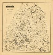
Map - Page 1 - Map of/NORTHERN... |
Map of/NORTHERN MAINE./=/Speci... |
|
HUBBARD, LUCIUS L. |
1896 |
OML |
|
 |
Map - Page 1 - Map of/NORTHERN... |
Map of/NORTHERN MAINE./Special... |
|
HUBBARD, LUCIUS L. |
1900 |
OML |
|
 |
Map - Page 1 - Map of/NORTHERN... |
Map of/NORTHERN MAINE./Special... |
|
HUBBARD, LUCIUS L. |
1900 |
OML |
|
 |
Map - Page 1 - Map of/NORTHERN... |
Map of/NORTHERN MAINE./Special... |
|
HUBBARD, LUCIUS L. |
1899 |
OML |
|
 |
Map - Page 1 - Map of/NORTHERN... |
Map of/NORTHERN MAINE./Special... |
|
HUBBARD, LUCIUS L. |
1894 |
OML |
|
 |
Map - Page 1 - MAP OF/PISCATAQ... |
MAP OF/PISCATAQUIS CO./MAINE. ... |
|
STUART and CO., J.H. |
1895 |
OML |
|
 |
Map - Page 1 - MAP SHOWING THE... |
MAP SHOWING THE/RAIL AND WATER... |
|
PORTLAND, PORT OF [D... |
1930-33- |
OML |
|
 |
Map - Page 1 - MAP/of the/DIST... |
MAP/of the/DISTRICT of MAINE,/... |
|
CARLETON, OSGOOD |
1802 |
OML |
|
 |
Map - Page 1 - MAP/of the/DIST... |
MAP/of the/DISTRICT of MAINE,/... |
|
CARLETON, OSGOOD |
1802 |
OML |
|
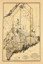 |
Map - Page 1 - MAP/OF THE/DIST... |
MAP/OF THE/DISTRICT OF MAINE/F... |
|
Greenleaf, Moses |
1816 |
OML |
|
 |
Map - Page 1 - MAP/OF THE/STAT... |
MAP/OF THE/STATE OF MAINE/FROM... |
|
GREENLEAF, MOSES |
1822 |
OML |
|
 |
Map - Page 1 - MAP/OF THE/STAT... |
MAP/OF THE/STATE OF/MAINE[vers... |
|
HOME EDUCATOR COMPAN... |
1905 |
OML |
|
 |
Map - Page 1 - MAP/of the/VARI... |
MAP/of the/VARIOUS LINES/BETWE... |
|
GRAHAM, MAJOR JAMES ... |
1846 |
OML |
|
 |
Map - Page 1 - MAP/OF/PORTLAND... |
MAP/OF/PORTLAND HARBOR./Maine.... |
|
ANDERSON, JOHN ( U.S... |
1834 |
OML |
|
 |
Map - Page 1 - MAP/OF/THE STAT... |
MAP/OF/THE STATE OF /MAINE/WIT... |
|
GREENLEAF, MOSES [II... |
1844 |
OML |
|
 |
Map - Page 1 - MAP/OF/THE STAT... |
MAP/OF/THE STATE OF/MAINE/Comp... |
|
COLBY and CO., GEORG... |
1884 |
OML |
|
 |
Map - Page 1 - MAP/OF/THE STAT... |
MAP/OF/THE STATE OF/MAINE/Comp... |
|
COLBY and CO., GEORG... |
1885 |
OML |
|
 |
Map - Page 1 - MAP/OF/THE STAT... |
MAP/OF/THE STATE OF/MAINE/Comp... |
|
STUART and CO., J.H. |
1890 |
OML |
|
 |
Map - Page 1 - MAPA GEOGRAFICO... |
MAPA GEOGRAFICO/QUE COMPREHEND... |
|
LOPEZ, TOMAS |
1778 |
OML |
|
 |
Map - Page 1 - MAPPA/GEOGRAPHI... |
MAPPA/GEOGRAPHICA/AMERICAE/SEP... |
|
EULER, LEONHARD von |
1755 |
OML |
|
 |
Map - Page 1 - Mr. Just. Henry... |
Mr. Just. Henry Pennars Plann ... |
|
MARTIN, JOHN JUNR. |
1776 |
OML |
|
 |
Map - Page 1 - NAINE/and the/D... |
NAINE/and the/DISPUTED TERITOR... |
|
FAMILY MAGAZINE OR M... |
1839 |
OML |
|
 |
Map - Page 1 - New Commercial,... |
New Commercial, Sportsmen's an... |
|
BULLARD COMPANY, THE |
1915 |
OML |
|
 |
Map - Page 1 - New Commercial,... |
New Commercial, Sportsmen's an... |
|
BULLARD COMPANY, THE |
1909 |
OML |
|
 |
Map - Page 1 - New Commercial,... |
New Commercial, Sportsmen's an... |
|
BULLARD COMPANY, PUB... |
1910 |
OML |
|
 |
Map - Page 1 - New Map of/MAIN... |
New Map of/MAINE/Compiled from... |
|
MANSFIELD, J.B. [CER... |
1855 |
OML |
|
 |
Map - Page 1 - NIEUW/ENGELAND/... |
NIEUW/ENGELAND/in Twee/Scheept... |
|
AA, PIETER VANDER |
1707 |
OML |
|
 |
Map - Page 1 - NORTH AMERICA/E... |
NORTH AMERICA/EAST COAST/BAY O... |
|
ADMIRALTY, HYDROGRAP... |
1857 |
OML |
|
 |
Map - Page 1 - NOUVELLE ANGLET... |
NOUVELLE ANGLETERRE/NLLE. YORK... |
|
VAUGONDY, ROBERT de,... |
1749 |
OML |
|
 |
Map - Page 1 - NOUVELLE CARTE ... |
NOUVELLE CARTE PARTICULIERE DE... |
|
POPPLE, HENRY / COVE... |
1741 |
OML |
|
 |
Map - Page 1 - NOUVELLE/HOLLAN... |
NOUVELLE/HOLLANDE,/(a present/... |
|
AA, PIETER VANDER |
1714- |
OML |
|
 |
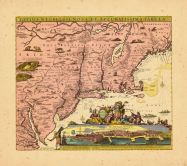
Map - Page 1 - NOVA BELGICA ET... |
NOVA BELGICA ET ANGLIA NOVA |
|
JANSSON, JAN |
1652-58 |
OML |
|
 |
Map - Page 1 - NOVA BELGICA ET... |
NOVA BELGICA ET ANGLIA NOVA |
|
JANSSON, JAN / VALK,... |
1710- |
OML |
|
 |
Map - Page 1 - NOVA TABULA GEO... |
NOVA TABULA GEOGRAPHICA COMPLE... |
|
VISSCHER, NICOLAS / ... |
1700- |
OML |
|
 |
Map - Page 1 - NOVA/BELGICA/ET... |
NOVA/BELGICA/ET/ANGLIA/NOVA |
|
BLAEU, WILLEM |
1638 |
OML |
|
 |
Map - Page 1 - NOVI BELGII NOV... |
NOVI BELGII NOVAEQUE ANGLIAE/P... |
|
VISSCHER, NICOLAS / ... |
1729- |
OML |
|
 |
Map - Page 1 - NOVI BELGII NOV... |
NOVI BELGII NOVAEQUE ANGLIAE/V... |
|
VISSCHER, NICOLAS |
1684 |
OML |
|
 |
Map - Page 1 - NOVI BELGII NOV... |
NOVI BELGII NOVAEQUE ANGLIAE/V... |
|
ALLARD, HUGO |
1662- |
OML |
|
 |
Map - Page 1 - NOVI BELGII,Quo... |
NOVI BELGII,Quod nunc NOVI JOR... |
|
OGILBY, JOHN |
1670 |
OML |
|
 |
Map - Page 1 - NOVI BELGII,Quo... |
NOVI BELGII,Quod nunc NOVI JOR... |
|
OGILBY, JOHN |
1670 |
OML |
|
 |
Map - Page 1 - NOVI BELGII/NOV... |
NOVI BELGII/NOVAEQUE ANGLIAE N... |
|
DANCKERS, JUSTO |
1680- |
OML |
|
 |
Map - Page 1 - ORBIS TERRARUM ... |
ORBIS TERRARUM TYPUS DE INTEGR... |
|
PLANCIUS, PETRUS |
1599 |
OML |
|
 |
Map - Page 1 - PANORAMIC VIEW ... |
PANORAMIC VIEW OF THE/CITY OF ... |
|
STONER, J.J. |
1879 |
OML |
|
 |
Map - Page 1 - PART OF THE/UNI... |
PART OF THE/UNITED STATES./LOW... |
|
MASON, J[EMIMA] M. |
1840 |
OML |
|
 |
Map - Page 1 - PART OF THE/UNI... |
PART OF THE/UNITED STATES./LOW... |
|
MASON, J[EMIMA] M. |
1840 |
OML |
|
 |
Map - Page 1 - PART OF/NEW/ENG... |
PART OF/NEW/ENGLAND/Sold by I.... |
|
THORNTON, J. AND FIS... |
1689 |
OML |
|
 |
Map - Page 1 - PARTIE DES ETAT... |
PARTIE DES ETATS-UNIS. No.43. |
|
VANDERMAELEN, PHILIP... |
1827 |
OML |
|
 |
Map - Page 1 - PARTIE ORIENTAL... |
PARTIE ORIENTALE DU CANADA |
|
CORONELLI, V.M. / NO... |
1689 |
OML |
|
 |
Map - Page 1 - PARTIE/SEPTENTR... |
PARTIE/SEPTENTRIONALE/Des Poss... |
|
MITCHELL, JOHN / ANO... |
1778 |
OML |
|
 |
Map - Page 1 - Pas-Kaart/Vande... |
Pas-Kaart/Vande zee Kusten ind... |
|
KEULEN, JOHANNES van |
1684 |
OML |
|
 |
Map - Page 1 - Pascaerte van/N... |
Pascaerte van/NIEV NEDERLANT,/... |
|
JACOBSZ, THEUNIS [LO... |
1681 |
OML |
|
 |
Map - Page 1 - Plan of/PORTLAN... |
Plan of/PORTLAND/Harbour. |
|
BLUNT, EDMUND M. |
1815 |
OML |
|
 |
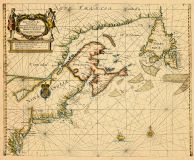
Map - Page 1 - PLAN/DE LA BAIE... |
PLAN/DE LA BAIE ET DU HAVRE DE... |
|
SOUTHACK, C. / SARTI... |
1779 |
OML |
|
 |
Map - Page 1 - PLAN/OF THE/Bri... |
PLAN/OF THE/British and Americ... |
|
DEARBORN, NATH'L / B... |
1843 |
OML |
|
 |
Map - Page 1 - PLAN/OF THE/TOW... |
PLAN/OF THE/TOWN OF WARREN,/WI... |
|
EATON, EMILY |
1851 |
OML |
|
 |
Map - Page 1 - PORTLAND HARBOR... |
PORTLAND HARBOR/MAINE/From a T... |
|
U.S. COAST SURVEY |
1866 |
OML |
|
 |
Map - Page 1 - PORTLAND HARBOU... |
PORTLAND HARBOUR |
|
ADMIRALTY, HYDROGRAP... |
1857 |
OML |
|
 |
Map - Page 1 - PRELIMINARY CHA... |
PRELIMINARY CHART/OF/PORTLAND ... |
|
U.S. COAST SURVEY |
1854 |
OML |
|
 |
Map - Page 1 - PRELIMINARY CHA... |
PRELIMINARY CHARTOF/PORTLAND H... |
|
U.S. COAST SURVEY |
1859 |
OML |
|
 |
Map - Page 1 - RAND McNALLY/ST... |
RAND McNALLY/STANDARD MAP OF/M... |
|
RAND McNALLY |
1954 |
OML |
|
 |
Map - Page 1 - RECENS EDITA/to... |
RECENS EDITA/totius/NOVI BELGI... |
|
SEUTTER, MATTHAUS / ... |
1762+ |
OML |
|
 |
Map - Page 1 - REVISED EDITION... |
REVISED EDITION./=/MAP OF/MOOS... |
|
HUBBARD, LUCIUS L. |
1883 |
OML |
|
 |
Map - Page 1 - REVISED EDITION... |
REVISED EDITION./=/MAP OF/MOOS... |
|
HUBBARD, LUCIUS L. |
1883 |
OML |
|
 |
Map - Page 1 - River Systems/O... |
River Systems/OF/MAINE/TO ILLU... |
|
COLTON and CO., G.W.... |
1869 |
OML |
|
 |
Map - Page 1 - RUSSELL'S NEW M... |
RUSSELL'S NEW MAP/OF/PORTLAND,... |
|
RUSSELL, JOHN and B.... |
1869 |
OML |
|
 |
Map - Page 1 - SACO AND BIDDEF... |
SACO AND BIDDEFORD, ME. |
|
BACHELDER, J[OHN]. B... |
1855- |
OML |
|
 |
Map - Page 1 - SHEET No I/PENO... |
SHEET No I/PENOBSCOT RIVER, MA... |
|
U.S. ARMY, CORPS OF ... |
1892 |
OML |
|
 |
Map - Page 1 - Sheet No III/Pe... |
Sheet No III/Penobscot River, ... |
|
U.S. ARMY, CORPS OF ... |
1892 |
OML |
|
 |
Map - Page 1 - Sheet No. II/Ma... |
Sheet No. II/Map of/Portion of... |
|
U.S. ARMY, CORPS OF ... |
1892 |
OML |
|
 |
Map - Page 1 - SKETCH OF/PORTL... |
SKETCH OF/PORTLAND HARBOR, MAI... |
|
U.S. ARMY, CORPS OF ... |
1880 |
OML |
|
 |
Map - Page 1 - SKETCH OF/PORTL... |
SKETCH OF/PORTLAND HARBOR, MAI... |
|
U.S. ARMY, CORPS OF ... |
1886 |
OML |
|
 |
Map - Page 1 - SKETCH OF/PORTL... |
SKETCH OF/PORTLAND HARBOR/INCL... |
|
U.S. ARMY, CORPS OF ... |
1887 |
OML |
|
 |
Map - Page 1 - Sketch of/SACO ... |
Sketch of/SACO RIVER, MAINE,/F... |
|
U.S. ARMY, CORPS OF ... |
1887 |
OML |
|
 |
Map - Page 1 - SKOWHEGAN, ME./... |
SKOWHEGAN, ME./SOMERSET CO.//D... |
|
NORRIS, GEO. E. |
1892 |
OML |
|
 |
Map - Page 1 - STATE OF MAINE/... |
STATE OF MAINE/HANCOCK/COUNTY |
|
PRENTISS and CARLISL... |
1931 |
OML |
|
 |
Map - Page 1 - STATE OF MAINE/... |
STATE OF MAINE/PENOBSCOT/COUNT... |
|
PRENTISS and CARLISL... |
1932 |
OML |
|
 |
Map - Page 1 - STATE OF MAINE/... |
STATE OF MAINE/WASHINGTON/COUN... |
|
PRENTISS and CARLISL... |
1931 |
OML |
|
 |
Map - Page 1 - TENTATIVE ZONIN... |
TENTATIVE ZONING PLAN/CITY OF ... |
|
PORTLAND ZONING COMM... |
1926 |
OML |
|
 |
Map - Page 1 - THE COAST/of/NE... |
THE COAST/of/NEW ENGLAND |
|
DES BARRES, J.F.W |
1781 |
OML |
|
 |
Map - Page 1 - The New England... |
The New England/Commercial and... |
|
BULLARD COMPANY, THE |
1909 |
OML |
|
 |
Map - Page 1 - The New England... |
The New England/Commercial and... |
|
BULLARD COMPANY, PUB... |
1910 |
OML |
|
 |
Map - Page 1 - The New England... |
The New England/Commercial and... |
|
HOME EDUCATOR COMPAN... |
1905 |
OML |
|
 |
Map - Page 1 - THE OFFICIAL MA... |
THE OFFICIAL MAP OF/MAINE/COMP... |
|
NATIONAL SURVEY CO.,... |
1914 |
OML |
|
 |
Map - Page 1 - The RAND McNALL... |
The RAND McNALLY/NEW COMMERCIA... |
|
RAND McNALLY and CO. |
1917 |
OML |
|
 |
Map - Page 1 - The RAND McNALL... |
The RAND McNALLY/NEW COMMERCIA... |
|
RAND McNALLY and CO. |
1917 |
OML |
|
 |
Map - Page 1 - THE STATES OF/M... |
THE STATES OF/MAINE/NEW HAMPSH... |
|
THRALL, WILLIS |
1834 |
OML |
|
 |
Map - Page 1 - The/PROVINCE/of... |
The/PROVINCE/of/MAINE/From the... |
|
LEWIS, SAMUEL / PAYN... |
1799 |
OML |
|
 |
Map - Page 1 - TOTIUS NEOBELGI... |
TOTIUS NEOBELGII NOVA ET ACCUR... |
|
ALLARD, HUGO / OTTEN... |
1720- |
OML |
|
 |
Map - Page 1 - UNTITLED CHART ... |
UNTITLED CHART OF THE COAST OF... |
|
NORMAN, JOHN |
1791 |
OML |
|
 |
Map - Page 1 - UNTITLED GLOBE ... |
UNTITLED GLOBE GORE |
|
CORONELLI, VICENZO M... |
1699- |
OML |
|
 |
Map - Page 1 - UNTITLED MS PLO... |
UNTITLED MS PLOT SURVEY, LYMAN... |
|
FROST, TIMO. |
1826 |
OML |
|
 |
Map - Page 1 - VILLAGE OF/NORW... |
VILLAGE OF/NORWAY/OXFORD COUNT... |
|
POOLE and CO., A.F. ... |
1886 |
OML |
|
 |
Map - Page 1 - WALDOBORO,/LINC... |
WALDOBORO,/LINCOLN COUNTY/MAIN... |
|
ANONYMOUS AMERICAN |
1896 |
OML |
|
 |
Map - Page 1 - YARMOUTH |
YARMOUTH |
|
BEERS, F.W. and CO. |
1871 |
OML |
|
 |
Map - Page 1 - YARMOUTH |
YARMOUTH |
|
BEERS, F.W. and CO. |
1871 |
OML |
|
 |
Map - Page 1 - [COAST OF MAINE... |
[COAST OF MAINE- DETAIL OF INN... |
|
DES BARRES J.F.W. |
1781- |
OML |
|
 |
Map - Page 1 - [COAST OF MAINE... |
[COAST OF MAINE- DETAIL OF PEN... |
|
DES BARRES, J.F.W |
1781- |
OML |
|
 |
Map - Page 1 - [COAST OF MAINE... |
[COAST OF MAINE- FALMOUTH HARB... |
|
DES BARRES, J.F.W. |
1781 |
OML |
|
 |
Map - Page 1 - [COAST OF MAINE... |
[COAST OF MAINE- FROM FRENCHMA... |
|
DES BARRES, J.F.W |
1781- |
OML |
|
 |
Map - Page 1 - [COAST OF MAINE... |
[COAST OF MAINE- FROM ROGER'S ... |
|
DES BARRES, J.F.W. |
1781- |
OML |
|
 |
Map - Page 1 - [COAST OF MAINE... |
[COAST OF MAINE- FROM SEAL HAR... |
|
DES BARRES, J.F.W. |
1781- |
OML |
|
 |
Map - Page 1 - [COAST OF MAINE... |
[COAST OF MAINE- FROM SPURWINK... |
|
DES BARRES, J.F.W. |
1781- |
OML |
|
 |
Map - Page 1 - [COAST OF MAINE... |
[COAST OF MAINE- MOOSE HARBOR ... |
|
DES BARRES, J.F.W |
1781- |
OML |
|
 |
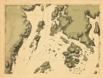
Map - Page 1 - [COAST OF MAINE... |
[COAST OF MAINE- MOUNT DESART ... |
|
DES BARRES, J.F.W |
1781- |
OML |
|
 |
Map - Page 1 - [COAST OF MAINE... |
[COAST OF MAINE- TWO VIEWS OF ... |
|
DES BARRES, J.F.W |
1781- |
OML |
|
 |
Map - Page 1 - [COAST OF ME, N... |
[COAST OF ME, NH, MA- CAPE ELI... |
|
DES BARRES, J.F.W. |
1777-82 |
OML |
|
 |
Map - Page 1 - [L HALF-]MAP OF... |
[L HALF-]MAP OF/MAINE [R HALF-... |
|
MATTHEWS-NORTHRUP CO... |
1891 |
OML |
|
 |
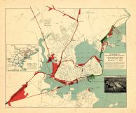
Map - Page 1 - [MAP-]BIRDS EYE... |
[MAP-]BIRDS EYE VIEW/SHOWING/P... |
|
WALKER LITH. and PUB... |
1909 |
OML |
|
 |
Map - Page 2 - A MAP OF THE/UN... |
A MAP OF THE/UNITED STATES/of/... |
|
ARROWSMITH, AARON |
1799 |
OML |
|
 |
Map - Page 2 - A MAP of/the mo... |
A MAP of/the most INHABITED pa... |
|
JEFFERYS, THOMAS / G... |
1794 |
OML |
|
 |
Map - Page 2 - GRAY'S ATLAS/MA... |
GRAY'S ATLAS/MAP OF/MAINE |
|
GRAY, O.W. |
1873 |
OML |
|
 |
Map - Page 2 - New Commercial,... |
New Commercial, Sportsmen's an... |
|
BULLARD COMPANY, THE |
1909 |
OML |
|
 |
Map - Page 2 - STATE OF MAINE/... |
STATE OF MAINE/WASHINGTON/COUN... |
|
PRENTISS and CARLISL... |
1931 |
OML |
|
 |
Map - Page 2 - The New England... |
The New England/Commercial and... |
|
BULLARD COMPANY, THE |
1909 |
OML |
|
 |
Map - Page 2 - UNITED STATES o... |
UNITED STATES of Nth. AMERICA/... |
|
TARDIEU, P.F. [AFTER... |
1812 |
OML |
|
 |
Map - Page 2 - [COAST OF MAINE... |
[COAST OF MAINE-TWO SHEET CHAR... |
|
DES BARRES, J.F.W |
1781- |
OML |
|
 |
Map - Page 3 - [MAP-]BIRDS EYE... |
[MAP-]BIRDS EYE VIEW/SHOWING/P... |
|
WALKER LITH. and PUB... |
1909 |
OML |
|

 Cart
Cart