 |
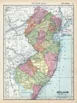
New Jersey |
World Atlas 1913 |
 |
Rand McNally and Com... |
1913 |
HMW |
 |
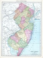
Page 067 - New Jersey |
World Atlas 1911c from Minneso... |
|
Rand, McNally and Co... |
1911 |
HMW |
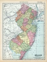 |
Page 082 - New Jersey |
World Atlas 1911c from Minneso... |
|
Rand, McNally and Co... |
1911 |
HMW |
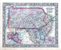 |
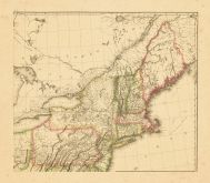
Pennsylvania, New Jersey, Mary... |
World Atlas 1864 Mitchells New... |
|
S. Augustus Mitchell |
1864 |
HMW |
 |
Map - Page 1 |
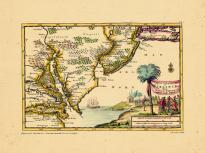
D'Engelze Volkplanting in Virg... |
|
AA, Pieter van der |
1707 |
OML |
|
 |
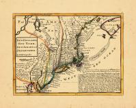
Map - Page 1 |
The Seat of Action Between the... |
|
Holland, Samuel |
1776 |
OML |
|
 |
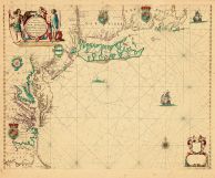
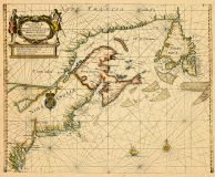
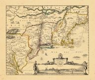
Map - Page 1 |
Nova Belgii Quod Nunc Novi Jor... |
|
[Ogilby, John] |
1671 |
OML |
|
 |
Map - Page 1 |
New England, New York, New Jer... |
|
Moll, Herman |
1729 |
OML |
|
 |
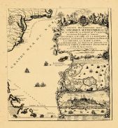
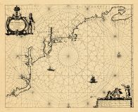
Map - Page 1 |
A Chart of Delaware Bay, With ... |
|
Des Barres, Joseph F... |
1779 |
OML |
|
 |
Map - Page 1 - A Chart/of the ... |
A Chart/of the Sea coasts of/N... |
|
SELLER, JOHN |
1675- |
OML |
|
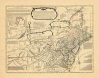 |
Map - Page 1 - A General/MAP o... |
A General/MAP of the/MIDDLE BR... |
|
EVANS, LEWIS / BOWLE... |
1765- |
OML |
|
 |
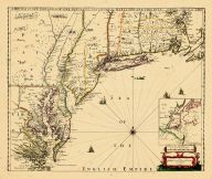
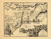
Map - Page 1 - A Map of/New EN... |
A Map of/New ENGLAND/New YORKE... |
|
MORDEN, ROBERT and B... |
1676 |
OML |
|
 |
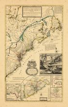
Map - Page 1 - A NEW AND CORRE... |
A NEW AND CORRECT MAP/OF THE/B... |
|
LAURIE and WHITTLE |
1794 |
OML |
|
 |
Map - Page 1 - A New and/ACCUR... |
A New and/ACCURATE MAP OF/NEW ... |
|
BOWEN, EMANUEL |
1752 |
OML |
|
 |
Map - Page 1 - A New Chart for... |
A New Chart for the/Seacoasts ... |
|
THORNTON, JOHN/FISHE... |
1687 |
OML |
|
 |
Map - Page 1 - A NEW MAP OF NE... |
A NEW MAP OF NEW ENGLAND-NEW Y... |
|
THORNTON, JOHN /ROBE... |
1690- |
OML |
|
 |
Map - Page 1 - A New MAP of/th... |
A New MAP of/the/BRITISH DOMIN... |
|
ANNUAL REGISTER / KI... |
1763 |
OML |
|
 |
Map - Page 1 - BELGII NOVI,/AN... |
BELGII NOVI,/ANGLIAE NOVAE, ET... |
|
JANSSON, JAN / SCHEN... |
1694 |
OML |
|
 |
Map - Page 1 - BELGII NOVI,/AN... |
BELGII NOVI,/ANGLIAE NOVAE, ET... |
|
JANSSONIUS, JOANNES |
1651 |
OML |
|
 |
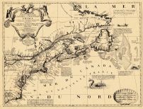
Map - Page 1 - CARTE/de la NOU... |
CARTE/de la NOUVELLE/ANGLETERR... |
|
BERTHOLON, C. |
1799 |
OML |
|
 |
Map - Page 1 - CARTE/DE LA PAR... |
CARTE/DE LA PARTIE NORD,/DES E... |
|
BONNE, RIGOBERT |
1780 |
OML |
|
 |
Map - Page 1 - CARTE/de la/Nou... |
CARTE/de la/Nouvelle ANGLETERR... |
|
LAPORTE, JOSEPH de |
1781 |
OML |
|
 |
Map - Page 1 - CARTE/DU/THEATR... |
CARTE/DU/THEATRE DE LA GUERRE/... |
|
BRION DE LA TOUR, LO... |
1778 |
OML |
|
 |
Map - Page 1 - Le Cours du/MIS... |
Le Cours du/MISSISIPI,/ou de S... |
|
FER, NICOLAS DE |
1718 |
OML |
|
 |
Map - Page 1 - MAPA GEOGRAFICO... |
MAPA GEOGRAFICO/QUE COMPREHEND... |
|
LOPEZ, TOMAS |
1778 |
OML |
|
 |
Map - Page 1 - MAPPA/GEOGRAPHI... |
MAPPA/GEOGRAPHICA/AMERICAE/SEP... |
|
EULER, LEONHARD von |
1755 |
OML |
|
 |
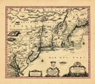
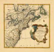
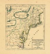
Map - Page 1 - New and Exact M... |
New and Exact MAP of the DOMIN... |
|
MOLL, HERMAN |
1732+ |
OML |
|
 |
Map - Page 1 - NOUVELLE ANGLET... |
NOUVELLE ANGLETERRE/NLLE. YORK... |
|
VAUGONDY, ROBERT de,... |
1749 |
OML |
|
 |
Map - Page 1 - NOUVELLE/HOLLAN... |
NOUVELLE/HOLLANDE,/(a present/... |
|
AA, PIETER VANDER |
1714- |
OML |
|
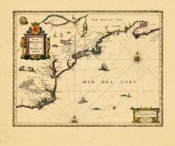 |
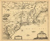
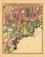
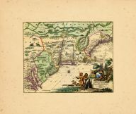
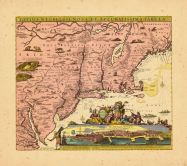
Map - Page 1 - NOVA BELGICA ET... |
NOVA BELGICA ET ANGLIA NOVA |
|
JANSSON, JAN |
1652-58 |
OML |
|
 |
Map - Page 1 - NOVA TABULA GEO... |
NOVA TABULA GEOGRAPHICA COMPLE... |
|
VISSCHER, NICOLAS / ... |
1700- |
OML |
|
 |
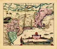
Map - Page 1 - NOVI BELGII NOV... |
NOVI BELGII NOVAEQUE ANGLIAE/P... |
|
VISSCHER, NICOLAS / ... |
1729- |
OML |
|
 |
Map - Page 1 - NOVI BELGII NOV... |
NOVI BELGII NOVAEQUE ANGLIAE/V... |
|
VISSCHER, NICOLAS |
1684 |
OML |
|
 |
Map - Page 1 - NOVI BELGII NOV... |
NOVI BELGII NOVAEQUE ANGLIAE/V... |
|
ALLARD, HUGO |
1662- |
OML |
|
 |
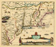
Map - Page 1 - NOVI BELGII,Quo... |
NOVI BELGII,Quod nunc NOVI JOR... |
|
OGILBY, JOHN |
1670 |
OML |
|
 |
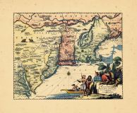
Map - Page 1 - NOVI BELGII,Quo... |
NOVI BELGII,Quod nunc NOVI JOR... |
|
OGILBY, JOHN |
1670 |
OML |
|
 |
Map - Page 1 - NOVI BELGII/NOV... |
NOVI BELGII/NOVAEQUE ANGLIAE N... |
|
DANCKERS, JUSTO |
1680- |
OML |
|
 |
Map - Page 1 - PARTIE ORIENTAL... |
PARTIE ORIENTALE DU CANADA |
|
CORONELLI, V.M. / NO... |
1689 |
OML |
|
 |
Map - Page 1 - Pascaerte van/N... |
Pascaerte van/NIEV NEDERLANT,/... |
|
JACOBSZ, THEUNIS [LO... |
1681 |
OML |
|
 |
Map - Page 1 - RECENS EDITA/to... |
RECENS EDITA/totius/NOVI BELGI... |
|
SEUTTER, MATTHAUS / ... |
1762+ |
OML |
|
 |
Map - Page 1 - TOTIUS NEOBELGI... |
TOTIUS NEOBELGII NOVA ET ACCUR... |
|
ALLARD, HUGO / OTTEN... |
1720- |
OML |
|
 |
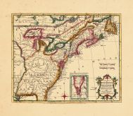
Map - Page 2 - A MAP OF THE/UN... |
A MAP OF THE/UNITED STATES/of/... |
|
ARROWSMITH, AARON |
1799 |
OML |
|
 |
Map - Page 2 - UNITED STATES o... |
UNITED STATES of Nth. AMERICA/... |
|
TARDIEU, P.F. [AFTER... |
1812 |
OML |
|

 Cart
Cart